

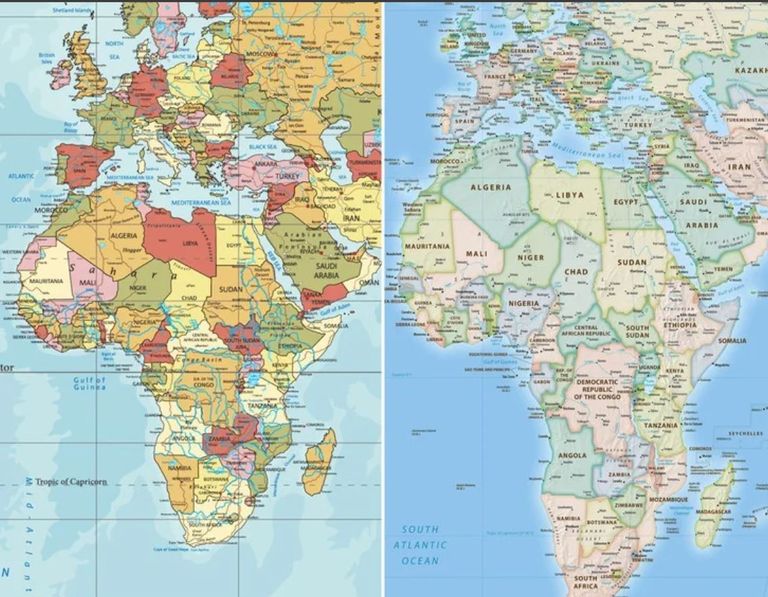
The United Nations General Assembly passed a resolution calling for the use of global maps that more accurately represent the relative size of the continents, in a move specifically aimed at correcting the depiction of Africa on traditional maps.
The resolution, led by Togo on behalf of the African Group, was supported by 164 countries, while the United States was the only country that voted against it, while 6 countries: Estonia, Georgia, Lithuania, Moldova, Serbia and Ukraine abstained.
The decision does not mean banning traditional maps or imposing a single map for the countries of the world, but it encourages governments, educational institutions, international organizations and digital platforms to use cartographic projections that better preserve the relative areas of continents, including the “flat earth” projection.
Why does the UN want to change the way the world map is drawn?
The problem is due to the widespread use of what is known as the “Mercator projection”, which was invented by the cartographer Gerardus Mercator in 1569 for marine navigation purposes.
This projection helps sailors determine directions and chart paths, but it does not store the true areas of countries and continents when the spherical surface of the Earth is superimposed on a flat map.
The degree of distortion increases as you approach the poles, making some regions of Europe, North America, and Greenland appear larger than their true relative size, while Africa and regions near the equator appear smaller.
One of the most famous examples is Greenland, which appears on Mercator maps as if it were close to Africa, even though the continent of Africa is about 14 times larger.
What is a Flat Earth Map?
The UN resolution promotes the use of the “flat earth” projection, which was developed in 2018 and aims to maintain roughly the correct proportions of land areas when representing the world’s flat surface.
There is no flat map that can convey the shape of the Earth without any distortion, because every cartographic projection is forced to sacrifice some accuracy in shape, area, distances or directions.
“Flat Earth” is characterized by prioritizing the representation of territories more realistically, forcing Africa to appear closer to its actual size compared to the Mercator map.
The decision will not cancel “Mercator”
The decision is not intended to eliminate the Mercator projection from the purposes for which it was created, especially navigation, but to limit reliance on it when the goal is to compare the areas of countries and continents.
This step requires increasing the use of flat area maps in schools, media, international institutions and digital platforms, in addition to educating students and the public that any flat map inevitably contains some distortion.
Supporters of the initiative believe that drawing the world is not only a technical issue, but also affects the visual perception of the size of countries and continents and their geographical position.
The decision provides impetus for Africa’s “Correct the Map” initiative, which seeks to show Africa its true relative size on globally used maps, after decades of making it appear smaller than it was due to the nature of some cartographic projections.
