

There aren’t many places where one would expect to find an ancient Mayan city, and outside of the Mesoamerica region, it would be quite a surprise.
But a graduate student was able to reach the lost Mayan city, which included pyramids, amphitheaters and sports stadiums, after a simple Google search landed on page 16 of search results.
It was Luke Old-Thomas, a doctoral student at Tulane University, who discovered the data that brought him to the city before working with a team of researchers to analyze it. The team believes that this discovery could be an indication of the existence of more hidden cities that are still waiting to be discovered.
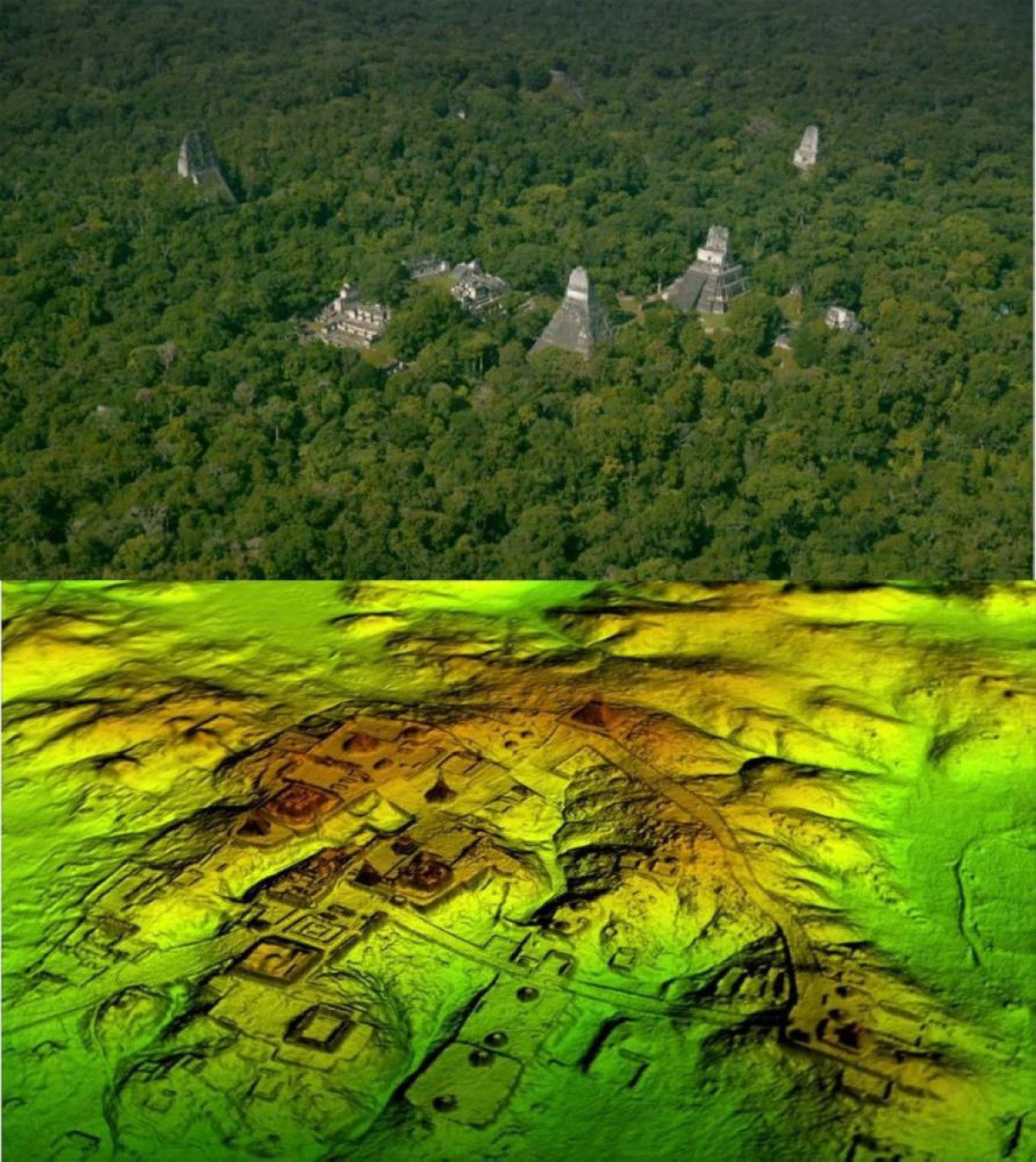
The secret to finding a Mayan city via Google was LiDAR technology, which used ancient aerial survey data to reveal traces of an entire city hidden under dense vegetation.
In the past, archaeological discoveries relied mostly on fieldwork, as researchers searched the site for signs of buried or vegetated buildings or structures. But the invention of the laser gave scientists a new way of measuring and mapping, and it became possible to use it to obtain information that was difficult to obtain with traditional methods.
The US National Oceanic and Atmospheric Administration (NOAA) states that LIDAR, which stands for Light Detection and Ranging, is a remote sensing technology that uses laser pulses to measure the distance to the Earth’s surface. When these pulses are combined with data captured by the airborne system, precise 3D information about the Earth’s shape and surface properties can be obtained.
LiDAR technology has already been used to identify archaeological sites in the past, but its use is not limited to archeology as it is also used to monitor environmental systems, according to the “iflscience” website.
Old-Thomas explains that the main difference between the use of technology by ecologists and archaeologists is that ecologists are interested in what is happening above ground, while archaeologists work in almost the opposite way; They start by digitally removing vegetation from the data, then look at the Earth’s surface for rubble, which is often ruined buildings that have become hills over time.
In 2024, Old-Thomas was inspired by researchers who used data collected by NASA for environmental purposes and turned it into archaeological research. He began searching Google for other datasets that could be analyzed using archaeological methods.
He said he looked through the search results until he got to about page 16, where he found a laser scan conducted by a Mexican environmental monitoring organization.
But the search result, which seemed to be buried among the pages of Google, turned out to be a special discovery. The team used algorithms that can distinguish between natural rock and man-made structures, revealing a vast site containing more than 6,500 structures dating back to before the arrival of the Spanish.
A big city with pyramids and stadiums
Old-Thomas said the data analysis not only revealed a densely populated area, but also showed great diversity in the nature of the clusters.
Not only did the explorers find villages and small colonies, but they discovered a large city that included pyramids, sports fields and arenas, located near the region’s only highway and a city whose inhabitants had been farming among the ruins for years. The most interesting thing is that neither the government nor the scientific community knew about the existence of the city.
The researchers named the city “Valeriana” after the nearby lake. Research results indicate that parts of it were probably built before 150 AD, while most of the city was built between 250 and 900 AD.
Valeriana’s heyday is thought to have occurred between 750 and 850 AD, before the wider disintegration of the Maya lowlands.
At its peak, the city is estimated to have housed around 30,000 to 50,000 people, which may help researchers re-evaluate the size of population centers in ancient Maya cities.
The survey data covers approximately 122 square kilometers with approximately 6,479 buildings monitored. Objects seen in the data apparently included temple platforms, plazas, ceremonial ball fields, residential platforms, and agricultural terraces, in addition to the facility believed to be a dam.
The significance of the research is that it not only offers a new way to find the lost city, but may also help scientists understand how densely populated the ancient Maya cities were.
LiDAR technology allows researchers to map large areas very quickly and with high accuracy and detail. When thousands of previously unknown buildings appeared, the initial conclusion seemed clear: if all these buildings existed, the population must have been enormous.
But the researchers faced another question: Were previous lidar surveys so tied to major, well-known sites like Tikal that they gave scientists a distorted picture of the Maya plains? What if the rest of the Maya region was more rural and the sites explored so far were the exception rather than the rule?
The new discovery points to a different picture. It appears that the Maya civilization was less rural than previously thought, and that its people lived in cities and complex societies, not just in isolated villages.
Marcelo A. said: Canuto, professor of anthropology at Tulane University and head of Old Thomas, said lidar is helping scientists see how the lowland Maya built a diverse tapestry of cities and communities in their tropical environment.
He explained that some areas included large agricultural areas and high population densities, while other areas included only small communities. However, researchers can now see the extent of the changes the ancient Maya made to their environment to support a complex, long-lasting society.
A discovery that may change the image of the Maya world
These results do not mean that all landmarks detected by LiDAR technology represent complete cities or that all detected buildings were used at the same time. The researchers caution that some of the features need to be verified in the field, as small piles of natural rock known locally as “chichi” can resemble the mounds of houses in aerial survey images.
LiDAR technology also reveals what is on the Earth’s surface, but it does not determine when objects have been used. Therefore, the presence of a large number of buildings in an area does not necessarily mean that they were all in use at the same time, nor can the population size be determined at a specific time based on aerial survey data alone.
However, Valeriana joins a series of discoveries through which lidar technology remaps the ancient Mayan world. In 2018, aerial surveys in Guatemala revealed more than 60,000 buildings and structures hidden under vegetation, along with roads, agricultural areas, canals and defensive structures, over an area of approximately 2,100 square kilometers.
These results showed that areas that are now empty forests once contained cities, densely populated communities, and developed agricultural networks, supporting the belief that the Maya civilization was more extensive and complex than what is shown by known archaeological sites on the surface of the earth.
Video
