
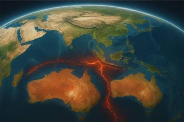
Australia is on the move… a continent that moves forward every year and prepares to change the map of the world
The map of the world before our eyes may appear static, as if the continents we know today will remain in place forever, but the truth has been revealed by new research that the Earth does not stop moving, and many of the changes that change the surface of the planet begin deep inside, where the tectonic plates move very slowly but constantly.
Among the most interesting examples is Australia, which is currently moving north and northeast at about 7 centimeters per year, becoming one of the fastest-moving continental masses on Earth’s surface. The distance may seem very small and may not be enough to notice any change in a day or a year, but when this movement is spread over thousands or millions of years, a few centimeters per year can completely redraw the geographical map of the planet.
Australia is getting closer to Asia every year
The continuous movement of the Australian continent is not only a geological phenomenon that is far from our lives, because its effects have already begun in the surrounding areas. As Australia moves north, it moves towards Southeast Asia, where the region’s tectonic plates collide, contributing to the formation of mountains and the uplift of some areas, in addition to seismic and volcanic activity. At this rate, Australia doesn’t need to wait millions of years before it begins to affect its neighbors, as the process has already begun, the Times of India website reported.
Faster than your nails grow
To simplify the idea of this slow motion, scientists sometimes use a very familiar example, comparing it to the growth of human nails. Clinical research has shown that the average nail growth is about 4.2 centimeters per year, and Australia moves about 7 centimeters per year.
Also read New Zealand plans to ban social networking sites for under-16s
In other words, the continent is moving north at about 1.7 times the speed of the growth of a human fingernail, and although we cannot feel this movement under our feet, it does not stop for a moment, and as decades, centuries, and then millions of years pass, these small steps turn into huge distances.
How do scientists know Australia is moving?
It may seem impossible to measure the movement of an entire continent, but scientists rely on very precise techniques. A network of satellite positioning stations is spread across Australia, operating continuously and tracking the locations of ground points with extreme accuracy.
By collecting thousands of measurements over many years, geologists can determine the actual direction and speed of movement of the Australian plate. Scientists not only record the apparent movement, but also work to rule out temporal changes that could affect the measurements, such as ground movements from earthquakes, changes in groundwater levels, or seasonal water weight changes. In this way, a more accurate estimate of the true movement of the tectonic plate can be achieved.
Maps had to be linked to Australia
The consequences of the movement of the continent did not stop with geological studies, but reached maps and positioning systems. The former Australian National Coordinate System was established in 1994 and its coordinates remained fixed as long as the Australian landmass continued to move northward.
By 2020, this continuous drift caused a difference of about 1.8 meters between the locations determined by old official maps and the actual locations observed by modern positioning systems, so Australia was forced to update its reference system and launch GDA2020, with the aim of making official maps more compatible with real-time GPS locations. This accuracy is important in many fields, from satellite navigation, to surveying operations, and even to the use of agricultural machinery that relies on precise location data.
Also read An emperor penguin amazes surfers in an Australian video
A continent is not a plate
The study explained that there is a difference between the Australian continent and the Australian tectonic plate, as the continent is the thick land mass on which the population lives, while the Australian plate extends over much larger areas and includes much of the ocean floor along with the West Zealand region.
Tectonic plates are not just solid particles floating on a sea of liquid lava, as some might think. Plates are solid parts of the Earth’s outer shell that move over hotter mantle rocks that can deform very slowly over long geological periods.
The collision with Asia is already happening
The results of tectonic movement are clearly visible in northern Australia. The oceanic crust of the Australian Plate subducts into the Java Trench beneath the Sunda region, while in other regions, particularly around Timor and New Guinea, active collisions occur between continental rocks and the smaller Southeast Asian plates.
These ongoing geological processes lead to a number of phenomena, including uplift of the earth’s surface, the formation of mountain ranges, the generation of earthquakes, as well as volcanic activity in various parts of the region.
From Gondwana to a new supercontinent
Australia’s current movement is not a separate or new chapter in Earth’s history, but is part of a journey that began millions of years ago. In the distant past, Australia was part of Gondwana, an ancient supercontinent that included areas that are now separate continents, and Australia was connected to Antarctica.
But the two blocks gradually began to separate, and over time Australia drifted northward, and its northward movement accelerated about 45 million years ago, and now geodynamic models are trying to predict the next stage of this journey.
Some models suggest that in about 200 to 300 million years, Australia may completely collide with Asia, in a massive process that could lead to the formation of a new supercontinent known as “Amasia”.
In this future scenario, the coming together of the continents could cause the Pacific basin to close almost completely, revealing a radically different map than what we know today.
Will “this” become a reality?
While the idea of a new supercontinent sounds exciting, it is not an accurate map of Earth’s future. The movement of tectonic plates over hundreds of millions of years is extremely difficult to predict, and the current rate gives scientists a better picture of what may happen in the next millions of years, but the longer the time, the more difficult the predictions become.
New subduction zones may appear, or plate movement directions may change. Indeed, the motion of the entire plate can change as a result of major geological changes. Therefore, “Amasya” represents a possible scientific scenario based on models of geodynamic physics, but it is not a definitive prediction of what the Earth’s map will look like hundreds of millions of years from now.